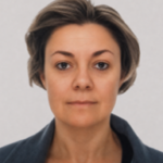
Marica Franzini
Researcher
Biography
Marica Franzini conducts research in Geomatics at the Department of Civil Engineering and Architecture of the University of Pavia. She is a member of the permanent staff of the Laboratory of Geomatics, where she contributes to scientific, teaching, and technical support activities for research.
Her work focuses on the acquisition, processing and quality assessment of geospatial data. Her main areas of interest include aerial and UAV photogrammetry, LiDAR surveying and mobile mapping, point-cloud processing and classification, remote sensing, GIS, and the development of three-dimensional models and digital twins. Her applied activities address land and territory, the environment, the built heritage and infrastructure.
Within the laboratory, she participates in research projects, third-mission activities, and collaborations with public bodies, institutions, and external stakeholders.
In the 2026/2027 academic year, she contributes to the teaching of GPS/GNSS Positioning, Digital Surveying of Land and Buildings, and the Digital Surveying and Drones Laboratory. She is also the contact person for the professional bachelor’s degree program in Digital Technologies for Construction, Environment and Territory (TeDCAT).